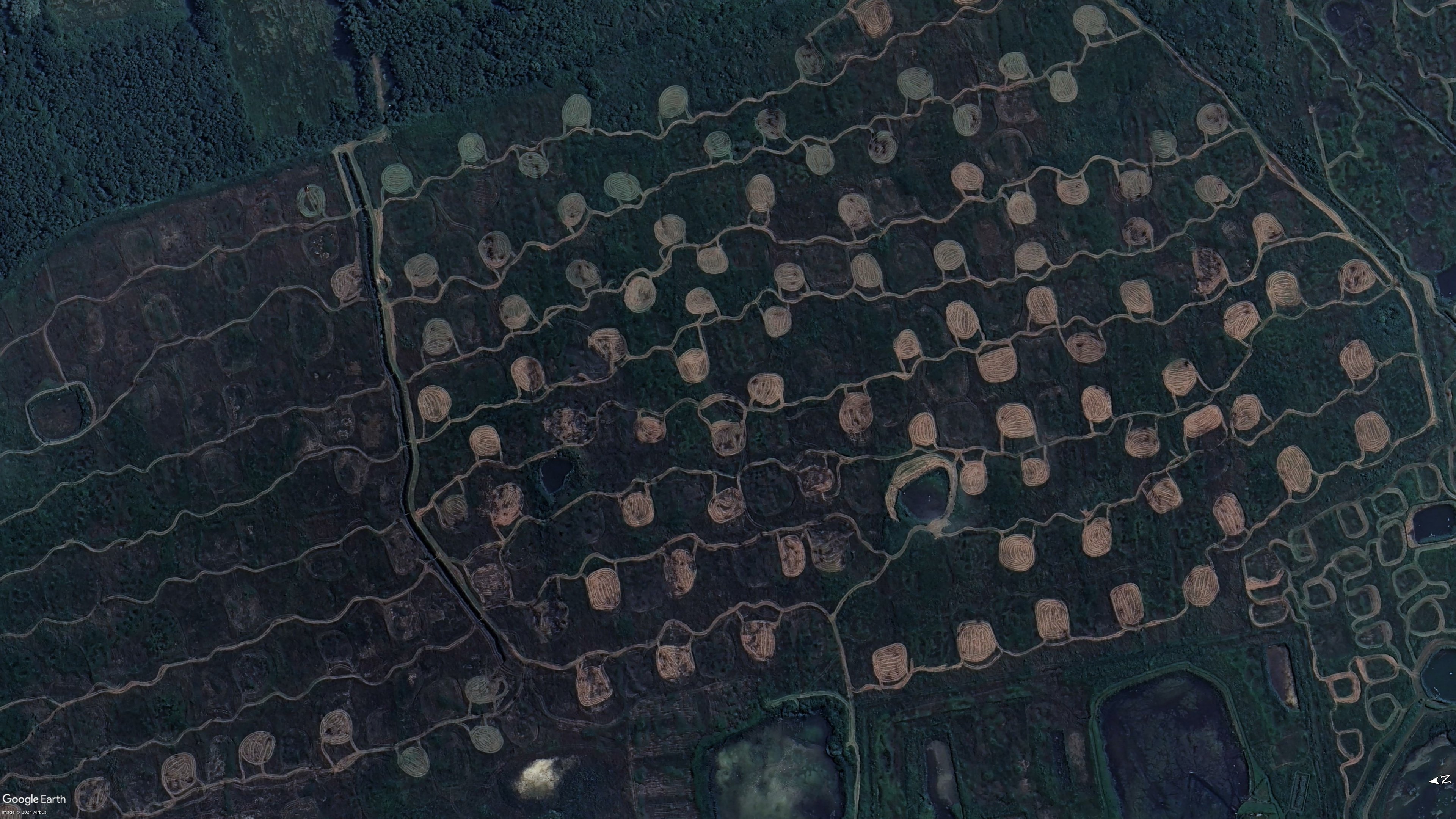
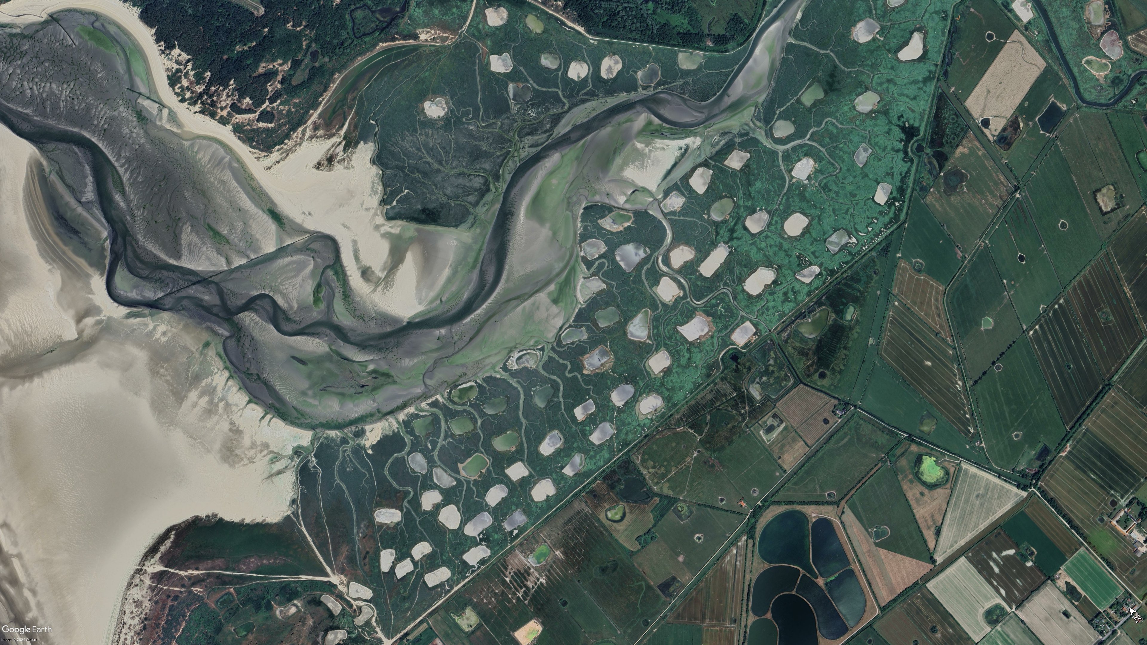
Unless I got the coordinates wrong, it appears to be part of a protected wetland area called Marais de Balençon. I can’t find much more information aside from hiking trails and this very short description on the merlimont website.
I might be off by a bit though, navigating maps on a phone is a pain for me.
I found an explanation on a French blog. These shapes are called “Platières à bécassines”. Bécassine is the French for the wild bird “snipe”. The idea is to cut the grass/vegetation on some patches of the swamp in June (when it’s dry), so that when water comes back in the autumn it creates small ponds that snipes like. It’s for bird/duck hunting purposes basically.
source
I think you’re right about the area
This page (google translated) suggests they are either mown fields, duck hunting areas, or areas disrupted and monitored for the effect on bees
Interestingly, I think the second photo from the carousel on your link shows one of these areas
You might be right. I could not discern anything in those blurry pictures for the life of me.
Interesting! Ill need to check that out when i am at a pc again. Its true, phones are not ideal foe everything…